2026 · Anthony Soumiatin
Do land listings in Branson need drone photos?
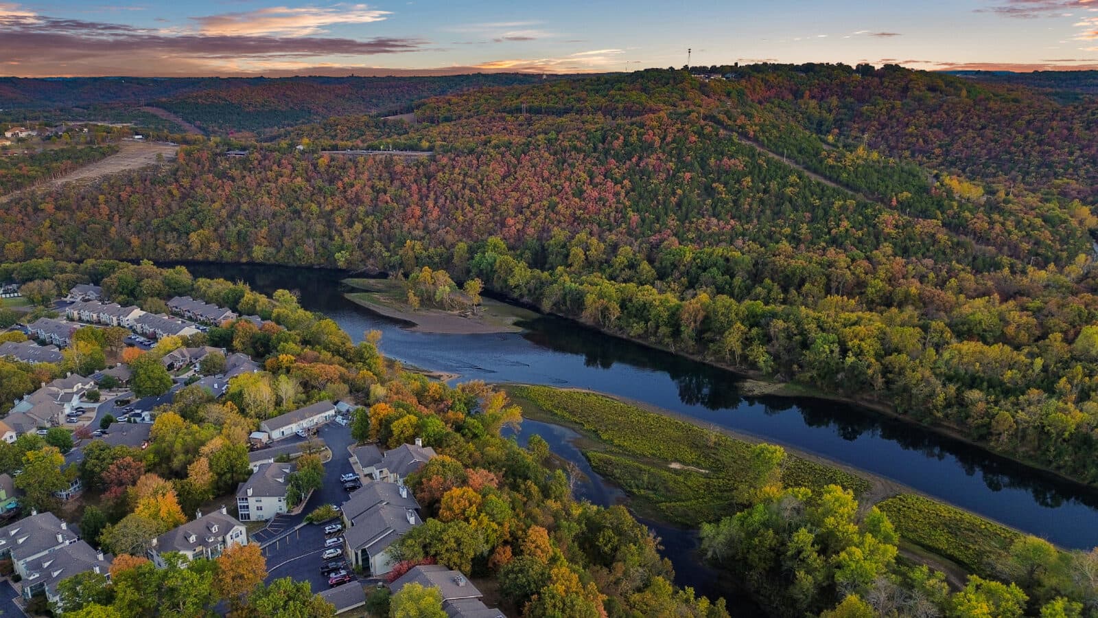
Yes. Branson-area land listings need drone photography because Ozarks terrain, heavy tree coverage, and irregular lot shapes make ground-level photos nearly useless for showing what a parcel actually contains. A single aerial frame can show slope, access roads, neighboring water, and the relationship between a lot and surrounding land in a way that a dozen ground shots cannot.
Why does Ozarks terrain make ground photos fall short?
The Ozarks are not flat. Parcels around Branson, Hollister, Kimberling City, and Table Rock Lake routinely drop 60 to 100 feet across the width of a single lot. A buyer standing at a property sign on the road has no way to see what is over the ridge line, how severe the grade is, or whether there is a buildable pad anywhere on the property.
Ground-level cameras are locked to one elevation. They can show trees, a gravel road, a "For Sale" sign. They cannot show:
- How far the lot extends past the tree line
- Whether the slope is gradual enough to build on without major grading
- Where road or easement access actually enters the parcel
- How close the parcel sits to a lake cove, river bend, or neighboring structure
- The relative position of the lot inside a development or subdivision
An aerial solves all of that in one frame. The camera is above the canopy, above the grade changes, and far enough back to give a buyer genuine spatial understanding of what they are looking at.
What an aerial photo specifically reveals about a land parcel
Here is what a drone shot captures that ground photography cannot:
- Slope and topography: the shape of the land is readable from above; buyers can see ridgelines, ravines, and buildable flats without visiting the site
- Tree coverage and density: whether the lot is fully wooded, partially cleared, or has open sections for a home site
- Road and driveway access: where the access road enters, how it runs through the property, and whether it is paved or gravel
- Boundary context: the general footprint and shape of the parcel relative to adjacent roads, structures, and water (note: exact legal boundaries come from a survey, plat, or GIS record, not a photo)
- Proximity to water: how close the lot sits to Table Rock Lake, a river arm, or a private cove
- Neighboring context: what surrounds the parcel, including any cleared land, structures, or road infrastructure that affects value
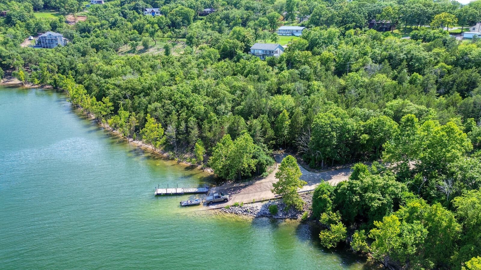
Does boundary context really show up in an aerial photo?
It can, and we have built a tool specifically for this. Our lot photography page includes a before/after slider that shows an aerial with and without a lot-line overlay. The overlay places the approximate parcel boundary directly on the image so buyers can see where the lot begins and ends in relation to surrounding features.
One important clarification: the overlay shows approximate boundary context based on available plat and GIS data. It is a visual aid for buyer orientation, not a legal survey. Any buyer relying on exact acreage or setback distances should consult the recorded plat or commission a licensed survey. That said, for most land buyers comparing five parcels on a weekend, being able to see the rough shape and extent of a lot on an aerial is far more useful than a legal description alone.
When standalone drone photography is enough, and when land needs more
This depends on the parcel and how you are marketing it.
For raw land with no improvements, a standalone drone session is often sufficient. There is no interior to shoot, no curb appeal to establish from street level, and the aerial is where all the useful visual information lives. Our standalone aerial package for land listings is $145, and it covers the full drone session with edited deliverables, next-day turnaround.
When a parcel has improvements, a cabin, a well house, a cleared pad, a boat dock, or any structure a buyer would want to inspect closely, ground photos alongside the aerial give a complete picture. In that case, our photo packages starting at $195 include drone coverage automatically. You are not paying extra for the aerial; it is part of every package we offer.
A few situations where the full package makes more sense than drone only:
- The parcel has a cabin, barn, or any standing structure
- You want to show a cleared building site and the aerial view together
- The listing is for a lakefront lot with dock access that buyers will want to see from water level and from above
- You are marketing to out-of-state buyers who will not visit before making an offer
For most vacant lots, the $145 aerial is the right call. If the land is more complex, the package makes sense.
See the full drone photography details and pricing breakdown for current package options.
FAA licensing and why it matters for land drone photography
The FAA classifies commercial drone operations, including flying for real estate photography, as Part 107 operations. A pilot conducting commercial drone flights is required to hold an FAA Part 107 Remote Pilot Certificate (per the Federal Aviation Administration's commercial UAS rules). Flying commercially without that certificate is a federal violation and exposes the listing agent and property owner to liability.
Alexana Photography holds an FAA Part 107 license. That matters practically: we can legally fly at the locations where most land listings sit, including areas near controlled airspace and sites that require airspace authorization. If you have worked with a photographer who offered cheap drone shots without mentioning licensing, that is worth asking about before your next listing.
More on what the Part 107 requirement means for real estate listings is covered in our guide to drone licensing for real estate.
Delivery timeline and service area
We photograph the parcel and deliver edited aerials by the next day. For land listings that means you can have MLS-ready aerials the next day, which matters when you are trying to get a listing live before the weekend.
The process is straightforward: send the address, we fly the parcel, you get the edited files by the following day. No waiting a week for an editing queue.
Our service area covers Branson, Hollister, Kimberling City, and Table Rock Lake.